The building and development of Hadrian’s Wall
These teacher notes tell you about Hadrian’s Wall and the different stages of development that the wall went through. You can download a copy of these teacher notes below.
Download: The building and development of Hadrian's Wall PDF resource here (1.8 MB)
Hadrian’s Wall
Hadrian’s Wall ran for 80 Roman miles (73 modern miles/117 km) from Bowness-in-Solway to Wallsend. It was built to mark the north-west frontier of the Roman Empire and to repel invaders, but its sheer size was also intended to impress and overawe the people outside the empire.
The original design
There was already a frontier in place before the Wall was built, consisting of a series of forts connected by a road. Hadrian’s Wall was built slightly to the north of this. Most of the Wall was built in stone, with only a 42 km section at the western end built in turf (although this was later replaced by stone).
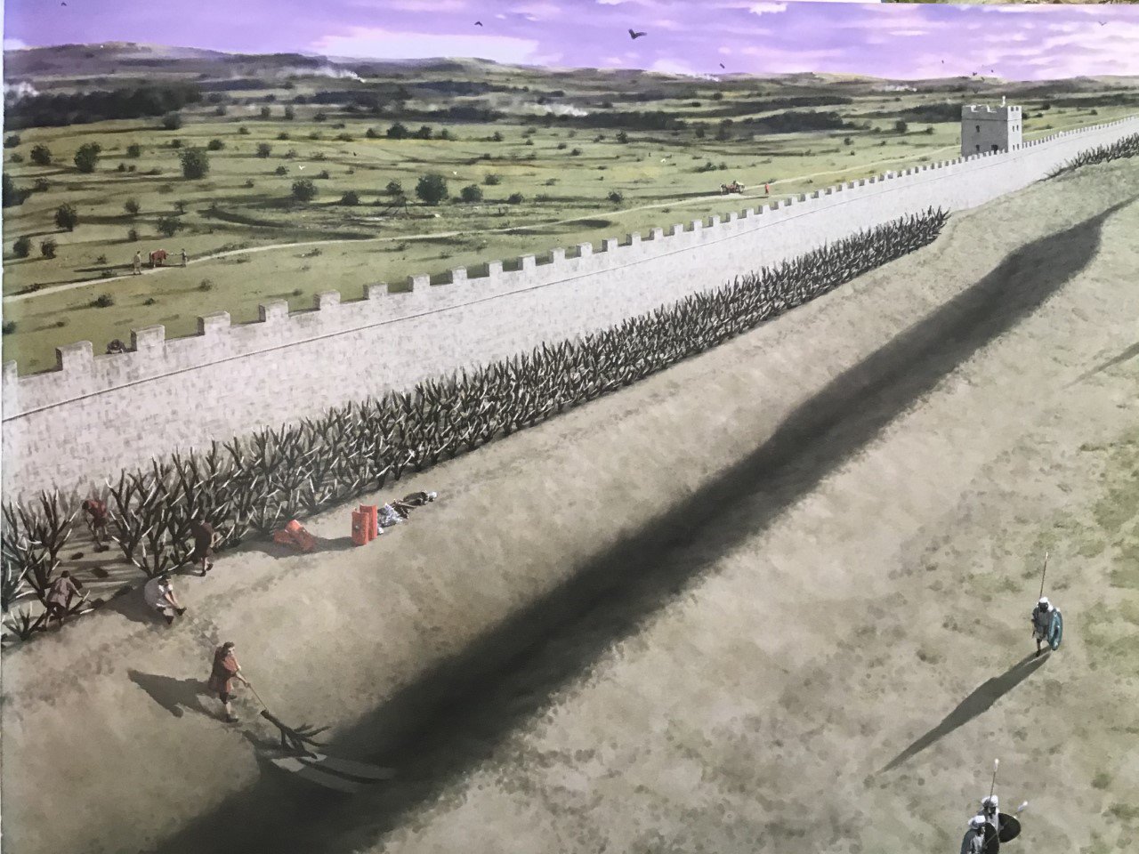
The Wall was first built to be 3m wide. In front of the wall was a large ditch and mound, except where crags or rivers made this unnecessary. In some parts there were branch entanglements (like barbed wire) between the fort and ditch.
Placed at one-mile intervals there were gates protected by a small-guard post called a milecastle. Between each pair of milecastles lay two towers (turrets), creating a pattern of observation points every third of a mile. The stone wall was approximately 15 feet high (4.6 metres) and 10 Roman feet (3 metres) wide (although the height and width did vary along the wall). It was therefore wide enough for a walkway and parapet wall on the top.
The second design
Before the original design was completed, there was a major change in plan. It was now decided to add forts to the wall itself, approximately 11 km apart. Behind the wall a massive earthwork was built (now called the Vallum), consisting of a massive flat-bottomed ditch flanked by two huge mounds. This marked the edge of the military zone to the south.
A third change of plan
Originally the Wall was going to finish at ‘Hadrian’s Bridge’ (Pons Aelius), a grand bridge across the River Tyne. Although the towns of Newcastle and Gateshead later grew up at this point, in the Roman period there was nothing there – even the fort at Newcastle was built many years later.
The new plan saw the Wall extended 6 km to the east and into the river, guarded by a fort. This stretch of Wall was only 2.5m wide, and there was no Vallum.
It is thought to have taken at least 6 years for the Wall to have been built and took approximately 15,000 soldiers to build it.
The Wall after Hadrian
The completed Wall had only been standing for about 10 years when Hadrian died and four years later the next emperor, Antoninus Pius started work on a new frontier much further north in Scotland, called the Antonine Wall. Hadrian’s Wall was neglected, but it is unclear if the fort at Wallsend was empty at this time or had a reduced garrison. Twenty years later, however, the Antonine Wall was abandoned and Hadrian’s Wall again became the frontier.
There was a major war in about AD 180 when armies attacking from the north over-ran parts of the Wall.
Over the years there were changes to the milecastles and major repairs were carried out. At Segedunum, there is evidence for the Wall falling down on at least three occasions because it had not been maintained properly.
The Wall after the Romans
Without anyone to maintain it, parts of the Wall gradually collapsed over the years. From the later Anglo-Saxon period, when people began to build in stone again, it was used as a convenient quarry for stone already cut to size. It still remained visible for many years, which is why the medieval villages of Wallsend and Walker include ‘wall’ in their name. Gradually, however, grass grew over it, soil built up and it disappeared – although the dip caused by the ditch were used as duck-ponds in local farms right up until the 1930s.